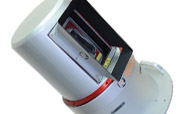
Terrestrial Scanning
RIEGL terrestrial laser scanners provide detailed and highly accurate 3D data rapidly and efficiently. Applications of RIEGL terrestrial laser scanners are wide ranging, including Topography, Mining, As-Built Surveying, Architecture, Archaeology, Monitoring, Civil Engineering and City Modeling.
Airborne Scanning
RIEGL airborne laser scanners make use of the latest state-of-the-art laser and signal processing technology. They are exceptionally compact, lightweight and cost effective, and are designed to meet the most challenging requirements in airborne surveying.
Unmanned Laser Scanning
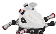
Laser Scanning utilizing high-end unmanned airborne platforms provides the possibility to acquire data in dangerous and/or hard-to-reach areas, while offering an excellent cost-to-benefit-ratio for numerous applications. With the survey-grade VUX-1UAV LiDAR Sensor and the versatile RiCOPTER, RIEGL provides a fully integrated LiDAR system solution for professional UAS surveying missions.
Mobile Scanning
Mobile laser scanning describes terrestrial data acquisition from moving platforms (e.g., boats, trains, road and off-road vehicles) also known as kinematic laser scanning. Both RIEGL 2D and 3D laser scanners are ideally suited for mobile mapping applications.
Industrial Scanning
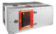
RIEGL´s industrial laser scanner product line is ideally suited to meet demanding industrial customer expectations. The rugged overall system design makes this product line exceptionally well suited for installations in harsh industrial environments. The compactness of the housing allows an installation even under narrow space conditions.
Distance Meters
RIEGL's distance meters provide accurate distance measurement for a variety of applications, e.g. industrial distance and speed sensing, collision avoidance for cranes and vehicles, level measurement in silos, distance measurements in high temperature areas, level measurement of liquid steel in melting pots or in transfer ladles.
With more than 40 years of experience in the research, development and production of laser scanners, rangefinders and distancemeters RIEGL delivers proven innovations in 3D.
Dedicated to designing, developing, and producing the best possible laser sensors for the desired application in order to perfectly fulfil the given measurement task and therefore fully satisfy the customers' expectations worldwide.


